- Community Spotlight, Success Stories, Uncategorized
- Satellite Science & Environmental Intelligence
Advancing Severe Weather Predictions with Artificial Intelligence
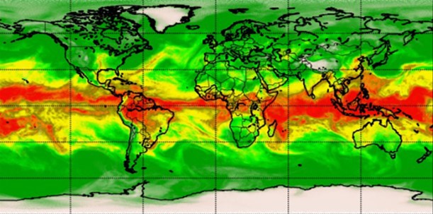
As artificial intelligence (AI) and machine learning (ML) technologies evolve in Earth sciences, CSS employee owners (formerly Riverside staff) are growing our expertise in this field. CSS employee owners are advancing technologies for our client, NOAA’s Center for Satellite Applications and Research (STAR). Our staff have developed a framework, exploiting modern AI/ML techniques, to rapidly evaluate the benefits and capabilities of Hyperspectral Microwave Sensors (HyMS) prototypes. HyMS are instruments that gather high spectral resolution data across a wide range of wavelengths within the microwave spectrum, enabling improved atmospheric temperature, moisture, cloud and precipitation sounding, nowcasting, and numerical weather prediction. CSS staff are currently doing assessments to determine the potential improvements that can be implemented into real-time monitoring of severe meteorological events, such as hurricanes, floods, and tornados.
These advancements will help forecasters better understand these events, where they are likely to occur, and be able to issue more advanced warnings to alert decision-makers and the public on preparations that can be made to help save property and lives.
Learn more about hyperspectral sensor technology and read the published journal article listed below.

See More CSS Insights
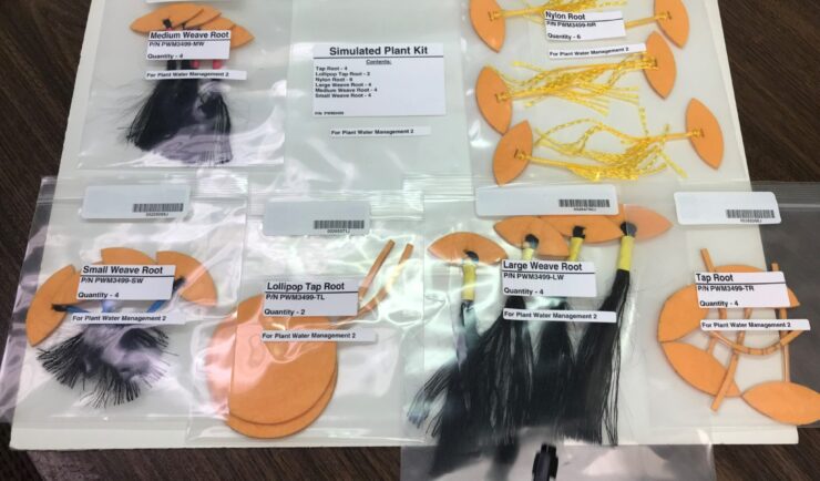
Astronauts Conduct Latest Plant Water Management on the International Space Station
NASA recently performed the sixth iteration of the CSS-supported Plant Water Management experiment on the International Space Station (ISS).

55 Years of Earth Day!
Since April 22, 1970 — that’s 55 years! — we’ve celebrated Earth Day to raise environmental awareness and support for environmental protection. At CSS we have a passion for the environment and through various government contracts, we work with our clients to overcome challenges to help protect this rock we call home. Below are a…
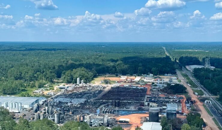
Responding to Tangipahoa River Contamination
Following a fire at Smitty’s Supply facility in Louisiana’s Tangipahoa Parish on August 22, 2025, a CSS employee owner supporting the Environmental Protection Agency’s Superfund Technical Assistance and Response Team (START) sub-contract deployed to the scene on August 31 to assist with response efforts. Initially the staff member worked on logistics at the staging warehouse.…