- Employee Spotlight
- Environmental Resource Assessment & Management
Going Above and Beyond During Difficult Circumstances

Congratulations to our Senior Program Analyst for receiving the Program Manager’s Spotlight Award, one of the highest levels of awards our company offers. She was nominated by her federal deputy director with the National Oceanic and Atmospheric Administration’s Coral Reef Conservation Program for quickly taking action upon the departure of the federal grants coordinator. She jumped into the role to help program process awards for several grant competitions to make sure the program met their statutory requirements. This would not have been possible without her assistance, professionalism, and long-term expertise.
A big thank you and congratulations!
See More CSS Insights
Continuing EPA Emergency Response Support
We’re proud to announce that the U.S. Environmental Protection Agency Region Six recently awarded the Superfund Technical Assessment & Response Team (START) contract to the Weston Solutions, Inc. (Weston) team. CSS has supported the START program nationwide since 2005 and START Region Six as a prime contractor (2006-2016) and subsequently as a subcontractor to Weston.…

1000 Samples of Lake Water Collected and Processed
Congrats to our team supporting U.S. Environmental Protection Agency’s Office of Research and Development for completing the processing and initial chemical analyses of 1000 lake water samples! They received lake water samples from across the continental U.S. this past summer and have completed the initial chemical analyses as part of the U.S. EPA 2022 National…
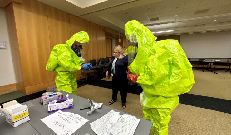
Providing Yearly Response Training
CSS scientists supporting the Environmental Protection Agency’s (EPA) Scientific and Technical Assistance for Consequence Management (STACM) contract are experienced in EPA’s emergency response efforts, both natural and manmade. To help EPA staff prepare for these emergency response efforts, CSS staff provide yearly response training. The training includes review of respiratory protection equipment, operation checks, a…