- CSS News, Success Stories
- Environmental Resource Assessment & Management
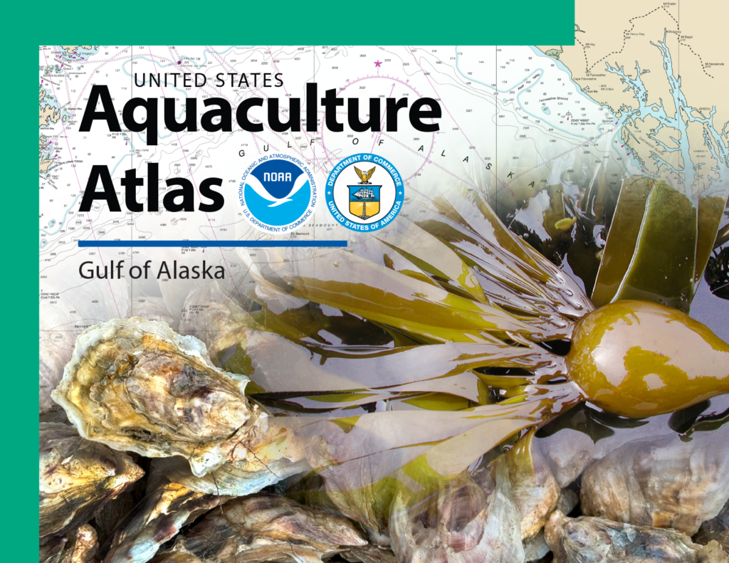
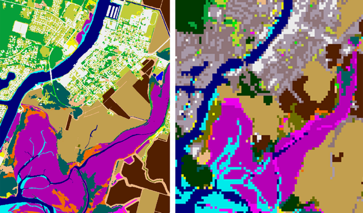
New Release: Aquaculture Atlas for the Gulf of Alaska
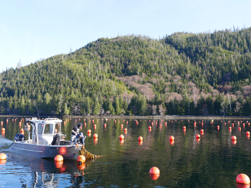
The National Oceanic and Atmospheric Administration (NOAA) has published An Aquaculture Opportunity Area Atlas for the Gulf of Alaska, which identifies 77 potential options in 10 study areas for establishing commercial seaweed and shellfish mariculture in Alaska state waters. For nearly three years, CSS employee owners have been working with partners through our contract with NOAA’s National Centers for Coastal Ocean Science (NCCOS) to support this extensive, cross-agency effort. Since 2023, CSS has supported NCCOS with this collaborative effort, working closely with NOAA Fisheries, other federal agencies, the State of Alaska, and wide range of stakeholders to support the expansion of domestic aquaculture opportunities. CSS staff (as part of our joint venture contract team of CSS-RPI) gathered data, developed maps, and performed a spatial suitability analysis to determine optimal locations for coastal aquaculture in Southeast, Southcentral, and Southwest Alaska.
CSS staff went above and beyond to complete this Atlas. In addition to performing the most comprehensive spatial planning effort to support U.S. aquaculture to date, the CSS-RPI team, along with NCCOS federal staff and in collaboration with the NOAA Fisheries Office of Aquaculture, held over 160 agency and community engagement meetings, hosted seven regional and 5 national listening sessions, and held two in person workshops. Feedback from these interactions resulted in updated AOA options in the most highly suitable locations that presented minimal conflict with existing ocean users and the surrounding ecosystem.
In addition, the CSS GIS Analysts supporting the team developed an Esri digital experience, Alaska Digital Atlas, for users to view interactive maps of the 10 study areas. Users can zoom in to the final options, and view data for each location related to the precision siting and cluster analysis, suitability modeling, and constrained area. For a high-level overview of the Alaska AOA planning process, CSS staff also supported the development of a complementary StoryMap “Growing the Future: Siting Alaska’s Aquaculture Opportunity”
This effort supports Presidential Executive Order (E.O.) 13921, Promoting American Seafood Competitiveness and Economic Growth (May 7, 2020), and E.O. 14276, Restoring American Seafood Competitiveness (April 17, 2025), which call for the expansion of sustainable seafood production in the U.S. to ensure food security; provide environmentally safe and sustainable seafood; support American workers; establish coordinated, predictable, and transparent federal action; and remove unnecessary regulatory burdens. Directives under E.O. 13921 require the Secretary of Commerce, in consultation with relevant federal agencies and state and tribal governments to identify Aquaculture Opportunity Areas suitable for commercial offshore aquaculture development.
This Atlas is the third in the series developed by this team, with existing atlases for the Gulf of America and Southern California (2021).
*Banner image credit: NOAA Fisheries
See More CSS Insights
Employee Owners Nominated for NOAA Gold Medal Award
Congratulations to CSS employee owners supporting NOAA’s National Centers for Coastal Ocean Science for their nomination for the NOAA Gold Medal Award! CSS employee owners have been critical members of the team charged with the rapid development of spatial models that aid in offshore wind planning in the Gulf of Mexico. The team has collected…
Installing Environmental Monitoring Stations
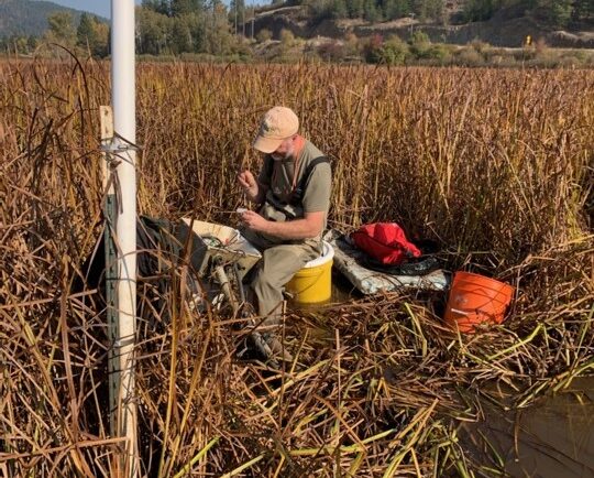
Our field crews installed/updated two environmental monitoring stations in remote locations in the Pacific Northwest. Multiple types of sensors were installed including air and soil temperature, precipitation, soil moisture and soil redox potential. These stations provide data for designing and evaluating soil remediation projects for U.S. Environmental Protection Agency’s Office of Research and Development. Installing…
New Heavily Desired High Resolution Land Cover Data for the U.S.
The National Oceanic and Atmospheric Administration recently announced the launch of the long desired high-resolution coastal land cover data. This highly anticipated data are available for most coastal areas of the U.S., including Alaska and the U.S. territories. CSS employee owners contributed to the release of this data set by participating in production activities and…