- Community Spotlight
- Environmental Resource Assessment & Management
Developing and Managing Lidar Data
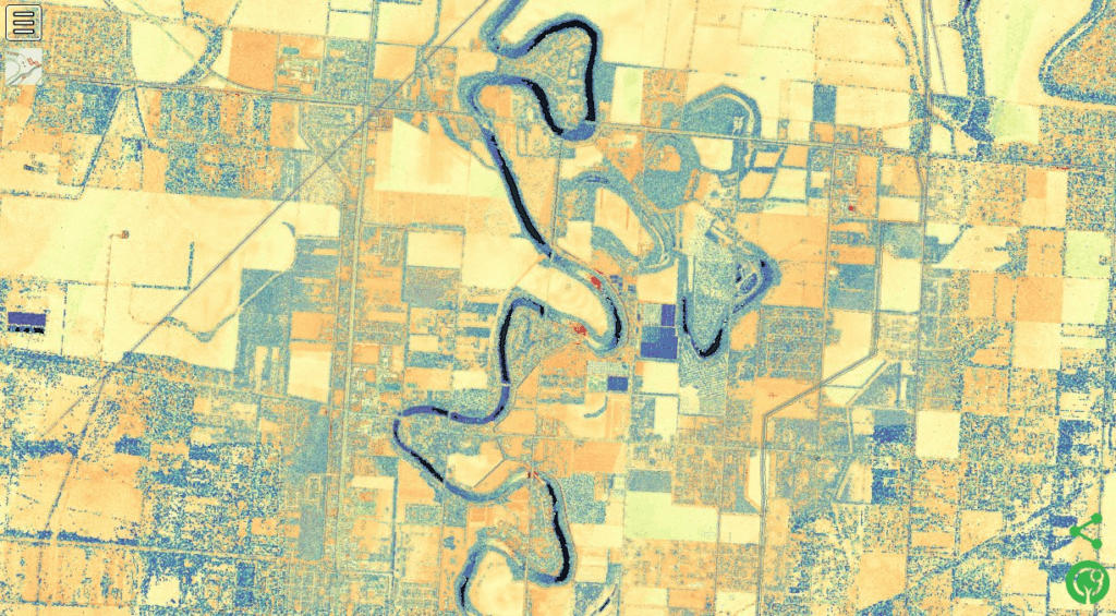
For over five years CSS employee owners have supported NOAA’s Digital Coast data development and management, training development and delivery, and tool development and management through our subcontract with Lynker Technologies supporting NOAA’s Office for Coastal Management. As part of this effort, CSS employee owners process lidar data from many sources to make it available for custom and bulk downloads from the NOAA Data Access Viewer. This involves ensuring data quality and consistency and preparing the data for dissemination. The end goal is to provide elevation data users with the data they need to make the best decisions for coastal mapping and management efforts.

See More CSS Insights

Employee Owners Nominated for NOAA Gold Medal Award
Congratulations to CSS employee owners supporting NOAA’s National Centers for Coastal Ocean Science for their nomination for the NOAA Gold Medal Award! CSS employee owners have been critical members of the team charged with the rapid development of spatial models that aid in offshore wind planning in the Gulf of Mexico. The team has collected…

Quality Assurance Audit Reports
Since 1985 we’ve supported the National Institute of Environmental Health Sciences and have provided more than 1,600 quality assurance audit reports that the client has used to assess the quality of toxicology studies they sponsor. Over the last year our employee owners reviewed several studies involving per- and polyfluorinated substances (PFAS) compounds, or “forever chemicals”,…

New Contract. Same Great Work.
We’re pleased to announce a new small business joint venture with Paul Bechtel & Associates (PB&A), which was awarded a 5-year contract to continue supporting the U.S. Environmental Protection Agency’s (EPA) Office of Pesticide Programs. For 40 years our staff have supported EPA’s Office of Pesticide Programs in the review and evaluation of pesticide data.…