- Community Spotlight, Success Stories, Uncategorized
- Satellite Science & Environmental Intelligence
Evaluating the Use of Earth Observations Digital Twin Technologies
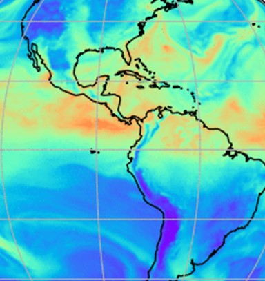
Earth Observations Digital Twin technologies are data analytics, artificial intelligence, and advanced modeling technologies that provide an estimate of the true state of the Earth. An Earth Systems Digital Twin is observations-based and grid-flexible with multiple components and high-resolution data over space and time to capture all available observations and feed a variety of direct observations to users. Adding or removing data is flexible, cost-efficient, and agile with fast processing. NOAA’s National Environmental Satellite, Data, and Information Service (NESDIS) is exploring the use of this technology.
Through their joint venture program, they contracted three companies to each developed a prototype to explore this technology. CSS employee owners (formerly Riverside staff) were responsible for evaluating these prototypes. Our staff evaluated the code for each Earth Observations Digital Twin prototype and explored using them for enhancing the ability to process, monitor, quality-control, consolidate, fuse, and assimilate environment observations and streamline the satellite data ground processing. Our staff provided feedback and recommendations to NESDIS regarding the validity and integrity of using an Earth Observations Digital Twin, and whether or not they could be used for potential future applications.

Learn more about how NESDIS is exploring the use of Earth Observations Digital Twin.
See More CSS Insights

Employee Owners Nominated for NOAA Gold Medal Award
Congratulations to CSS employee owners supporting NOAA’s National Centers for Coastal Ocean Science for their nomination for the NOAA Gold Medal Award! CSS employee owners have been critical members of the team charged with the rapid development of spatial models that aid in offshore wind planning in the Gulf of Mexico. The team has collected…
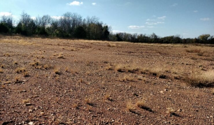
Remediating Soil Surrounding Abandoned Mines
CSS employees have been providing field, lab, and horticultural support for the Environmental Protection Agency’s efforts to develop and test methods for the remediation and revegetation of contaminated soils around selected abandoned mines in the western United States. One of the promising approaches is to incorporate biochar into the soil. Using biochar helps effectively adsorb trace metals and reduce their…

Overcoming COVID-19 Challenges
Great job to our team supporting our contract with the U.S. General Services Administration on assisting the client with conducting a year’s worth of environmental, health, and safety surveys in just six months! Due to limitations with COVID-19, the team was unable to conduct their surveys on their usual timeline and instead had to work…