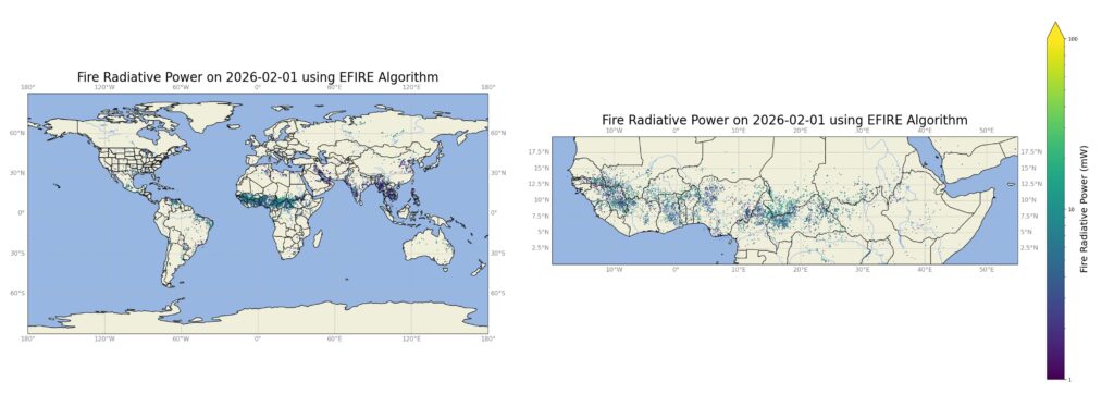
CSS provides fire detection support to the Atmospheric Science and Technology Applications team with NOAA’s National Environmental Satellite, Data, and Information Services. CSS Surface Characteristics Scientist serves on the Fire Emissions and Fire Detection teams, providing data manipulation, algorithm development, and performance evaluation for the system. This ensures fast and reliable satellite data to stakeholders, as well as researchers in the long-term. The CSS surface characteristics scientist will transition to Visible Infrared Imaging Radiometer Suite (VIIRS)-Based Next Generation Fire System data retrieval and validation for the U.S. Department of the Interior federal land fire cases. This system is an experimental satellite-based fire detection algorithm developed by the University of Wisconsin. It uses multi-band imaging capabilities to obtain high-resolution atmospheric imagery and generate a variety of applied products, one of which includes visible and infrared imaging for detecting fires, smoke, and atmospheric aerosols. CSS will be working on location accuracy of fire detection for the Next Generation Fire System.
See More CSS Insights
Providing Data Products for More Effective Consumption
The National Oceanic and Atmospheric Administration’s (NOAA) National Centers for Environmental Information (NCEI) is responsible for providing data, products, and services that help businesses and organizations operate more efficiently and effectively. As such, these data and products need to be available in a publicly accessible and digestible format the audience are able to understand. To…
Planning, Preparing for, and Participating in a Major Partner Workshop
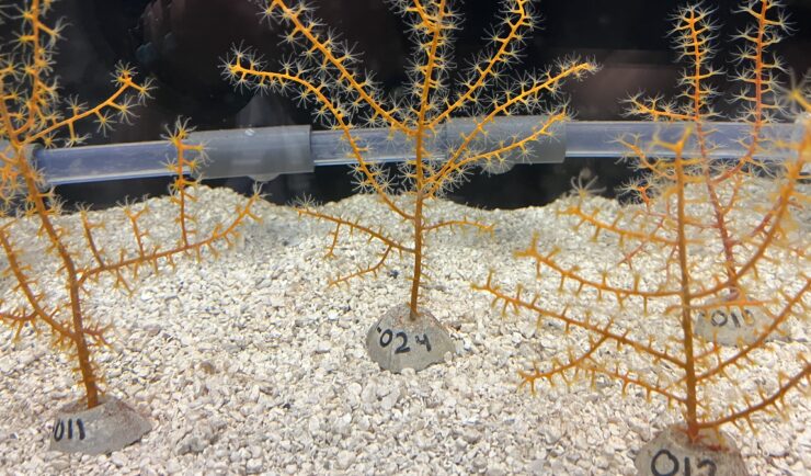
The Mesophotic and Deep Benthic Communities (MDBC) team with NOAA’s National Centers for Coastal Ocean Science attended a team meeting at the Wicker Center in Gulfport, Mississippi. CSS employee owners supporting this team (as part of our joint venture with RPI) participated in the meeting January 26-29. The objective of this workshop was for project managers, advisors, and partners to discuss 2025 accomplishments and plan next steps for 2026 and…
Responding to HazMat Spills
CSS supports several Centers for Disease Control and Prevention (CDC) campuses throughout the U.S. On-site CSS personnel are trained in hazardous material spill response and clean-up and provide this support within buildings and throughout campuses. As part of our contract with the CDC Hazardous Waste Program, CSS hazmat-trained employee owners are responsible for safely collecting,…