- Success Stories
- Environmental Resource Assessment & Management
New Heavily Desired High Resolution Land Cover Data for the U.S.
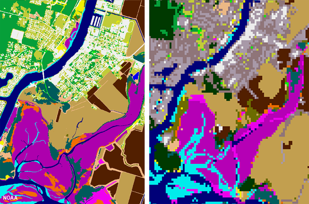
The National Oceanic and Atmospheric Administration recently announced the launch of the long desired high-resolution coastal land cover data. This highly anticipated data are available for most coastal areas of the U.S., including Alaska and the U.S. territories.
CSS employee owners contributed to the release of this data set by participating in production activities and providing quality assurance/quality control checks. In addition, the team has been presenting workflow processes and outputs, on-the-ground applications, and associated benefits of the data at conferences and to partners.
As part of this effort, CSS staff developed ESRI ArcGIS image services and a story map to facilitate distribution and understanding of the data. Following the NOAA press release, the land cover project team manager received an influx of questions expressing confusion regarding the data. CSS staff were tasked with rapidly developing this story map to better explain the points of confusion and direct users to the data download site. Staff completed this task within three business days of being assigned.
Previously, coastal land cover data was widely available at a 30-meter resolution. This new data is a 1-meter resolution product, which communities can use to improve sea level rise projections, protect communities from flooding, inform wetland restoration projects, and more. This is an especially important data set for Alaska, which has previously not had widespread land cover data available. Due to the costly nature of this high-resolution data, it was previously unobtainable for communities that couldn’t provide funding. Thanks to funding from the Bipartisan Infrastructure Law, NOAA was able to provide this data at a much larger scale.
Download the new high-resolution coastal land cover data through NOAA’s Digital Coast website,

See More CSS Insights
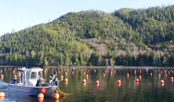
New Release: Aquaculture Atlas for the Gulf of Alaska
The National Oceanic and Atmospheric Administration (NOAA) has published An Aquaculture Opportunity Area Atlas for the Gulf of Alaska, which identifies 77 potential options in 10 study areas for establishing commercial seaweed and shellfish mariculture in Alaska state waters. For nearly three years, CSS employee owners have been working with partners through our contract with NOAA’s National Centers for Coastal Ocean Science (NCCOS) to support this extensive, cross-agency effort. Since 2023, CSS has supported NCCOS with this collaborative effort,…
Organizing National Mussel Watch Program Sample Collection Missions
Established in 1986, NOAA’s National Mussel Watch Program has been systematically monitoring nearly 600 chemical contaminants (including legacy organic contaminants, trace metals, and contaminants of emerging concern) and biological indicators for the establishment of baseline contamination levels in coastal waters around the U.S., including the Great Lakes, Puerto Rico, and U.S. Virgin Islands. CSS employee…

Ensuring Safety and Support for Sample Testing on the International Space Station
The International Space Station (ISS) gives scientists the opportunity to study the effects of space travel on human and plant tissues as well as understand how physical materials react during formation or exposure to a microgravity environment. CSS provides integrative expertise to NASA to support research and development and technology demonstrations conducted on the ISS,…