We’re pleased to announce a new small business joint venture with Paul Bechtel & Associates (PB&A), which was awarded a 5-year contract to continue supporting the U.S. Environmental Protection Agency’s (EPA) Office of Pesticide Programs.
For 40 years our staff have supported EPA’s Office of Pesticide Programs in the review and evaluation of pesticide data. Through this contract we assess pesticide safety─including its effects on non-target species and the endocrine system─as well as potential residues in crops.
Our new partnership brings together PB&A’s managerial experience with our team’s expertise in the scientific evaluation of pesticide data, and includes several additional team members with a history of supporting the Office of Pesticide Programs. This creates one top-notch team!

See More CSS Insights

CSS Employee-Owners’ 2025 Holiday Give Back Exceeds Goal
On November 1, 2025, CSS team members launched a Holiday Give Back campaign supporting Sarge’s Animal Rescue Foundation based in Waynesville, NC. Sarge’s is a 100 percent donor-funded non-profit supporting overcrowded shelters, rescue and rehabilitation for homeless animals, spay/neuter programs, behavior training and socialization, food and supply distribution and so much more. CSS team members launched the campaign November 1 on social media, giving CSS…
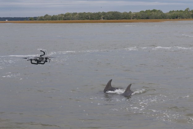
Examining Cetaceans for Contamination and Pathogens
CSS has employee owners who are experts in monitoring cetacean health. Several CSS scientists supporting NOAA’s Centers for Coastal Ocean Science have recently conducted research and tests on marine mammals to explore uncommon behaviors and causes for strandings. View some examples of this research below. Microplastics are becoming increasingly abundant in coastal and marine environments.…
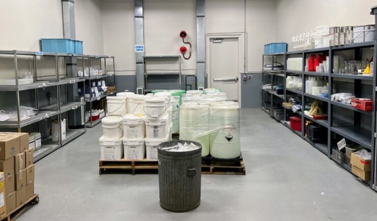
Extensive Support in Hazard Waste Management
For 22 years, CSS has provided support to the Centers for Disease Control and Prevention (CDC) Hazardous Waste Program ensuring safe handling, storage, packing, and shipping of hazardous waste materials within facilities and laboratories. Experienced CSS employees are located on site at CDC campuses in Atlanta, Georgia, San Juan, Puerto Rico, and Fort Collins, Colorado and are responsible for collecting waste on a weekly schedule and disposing of waste at various campuses on an annual…